

New feature alert!
At Save Cantonese, we love projects that connect people with Hong Kong culture in fresh and creative ways. That’s why we’re so excited to showcase CantoPop Map, an interactive tool created by one of our amazing volunteers, Devon Crebbin.
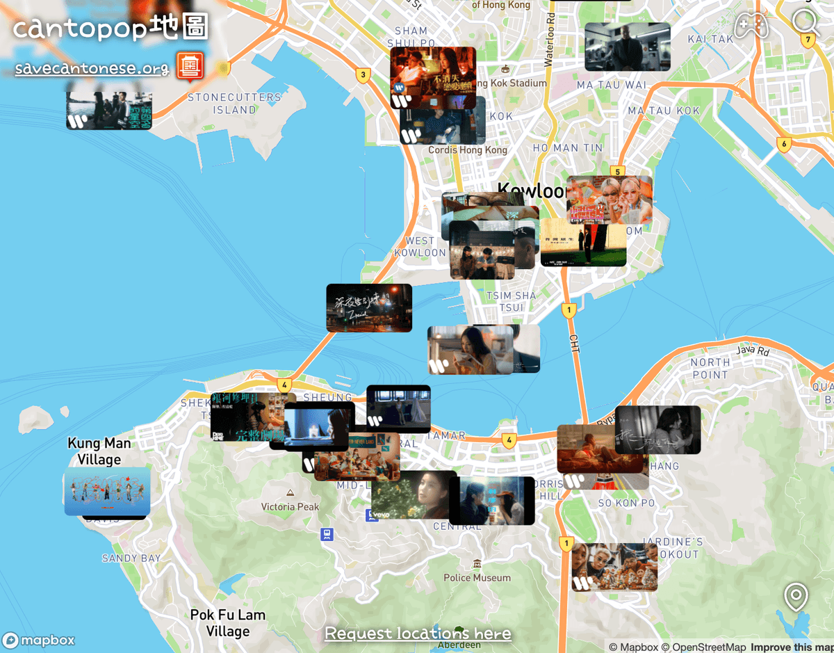
The CantoPop Map lets you explore Hong Kong through the lens of Cantonese music videos. Each pin on the map represents a real filming location. With just a click, you can:
- See the exact spot where the video was filmed
- Jump to the timestamp in the music video
- Get directions to the location
- Peek at Google Street View (when available)
- Discover not just artists, but also the behind-the-scenes contributors who make Cantopop possible
There’s even a game built in: Cantopop Guesser, a geoguesser-style challenge where you match a Street View location to the right music video.
The story behind the project is just as fun. While researching Cantonese AI and living in Hong Kong, Devon dove deep into Cantopop, tracking down music video spots across the city. What started as a personal scavenger hunt soon became a fully interactive map, one that’s already been visited more than 1,500 times and even caught the attention of artists like 雲浩影, Gareth T, Gordon Flanders, and Moon Tang.
The vision for CantoPop Map is bigger still: to include classics alongside modern favorites, giving overseas Hong Kongers and Cantonese speakers everywhere a way to reconnect with the city’s streets, culture, and songs. Imagine planning a trip to Hong Kong and retracing the steps of your favorite artist, or rediscovering the songs of your youth through the places where they were filmed.
Click below to try it out, and see where CantoPop takes you!